
Matt Bandy and Rosalinda Palomo Ramos prepare to fly a drone
In the fast-evolving world of technology, artificial intelligence has found its way into an unexpected realm—turtle conservation. An initiative led by the Turtle Conservancy, in collaboration with HABIO and Resi, the firm founded by Matt Bandy, brought together a team comprising Rosalinda Palomo Ramos, Matt Bandy, Michael Tuma, and Ross Kiester (myself). Our mission took us to the Turtle Conservancy's Bolson Tortoise Preserve in Bolson de Mapimí, where we harnessed the power of drones and AI to estimate tortoise populations.

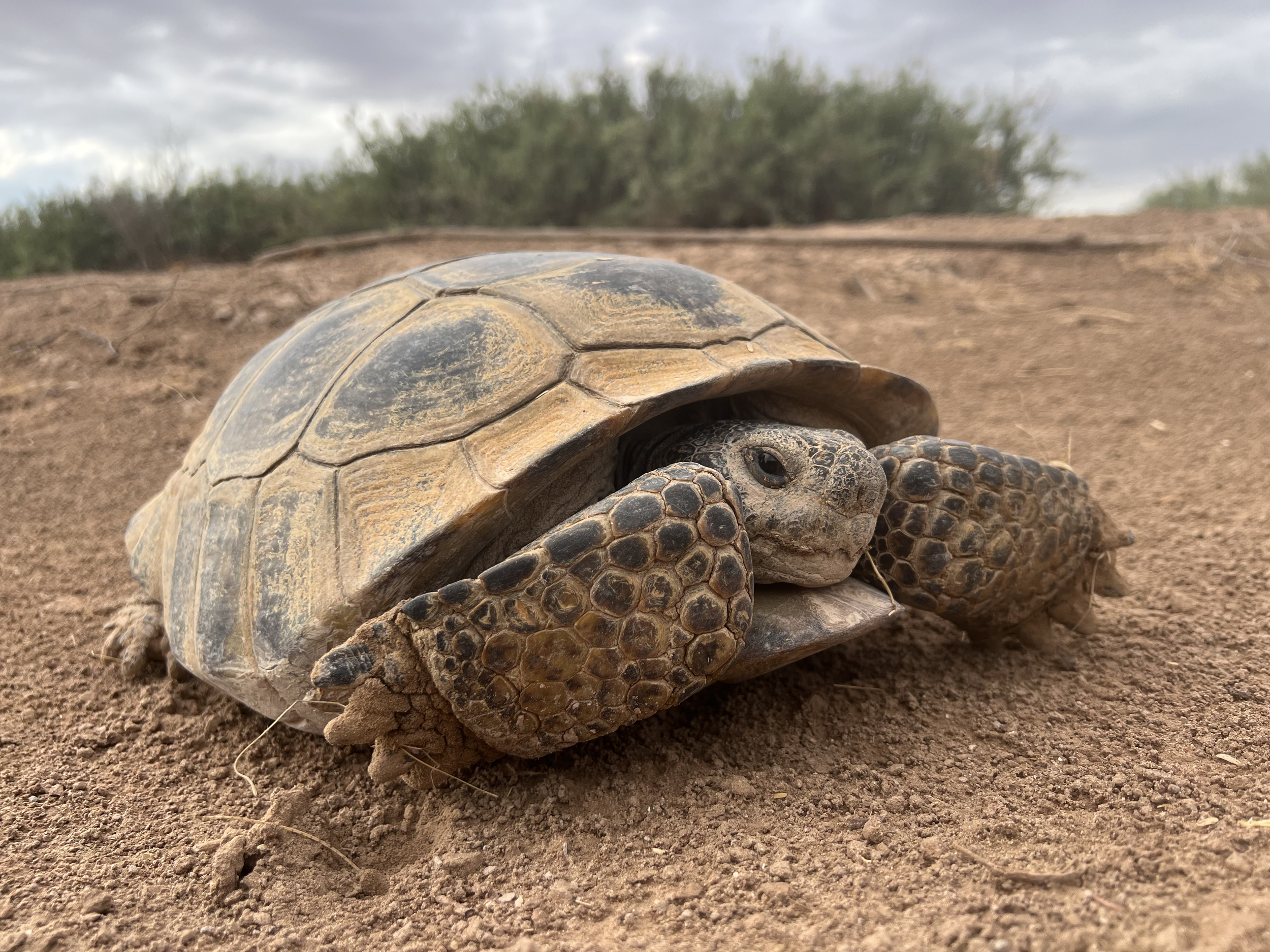
A Bolson Tortoise (Gopherus flavomarginatus) emerges from it’s burrow
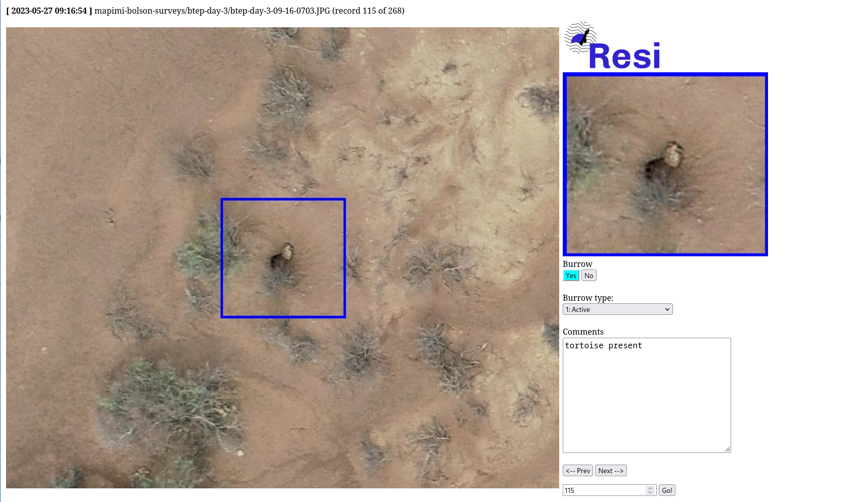
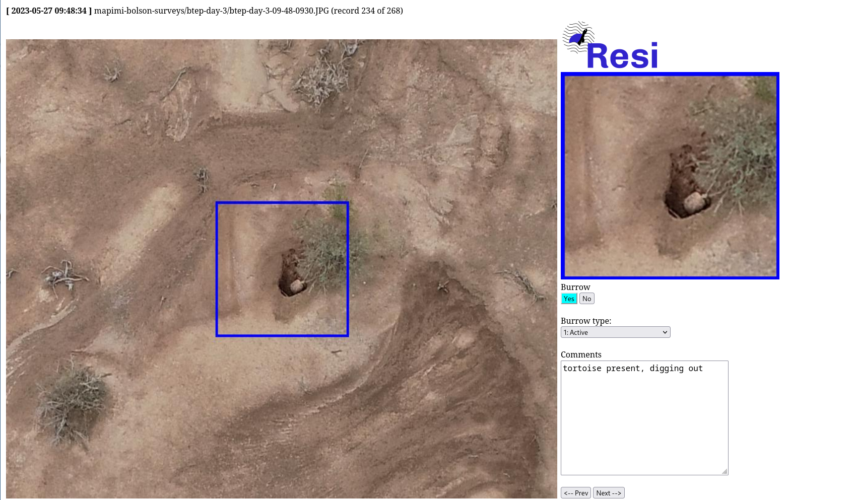
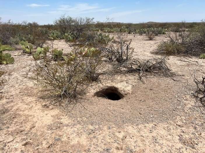
Our target species was the elusive Bolson Tortoise (Gopherus flavomarginatus), known to spend a mere one percent of its time above ground and the rest of its time hidden away in deep underground borrows. Covering an extensive area of 44,000 acres at Rancho San Ignacio, the task of estimating their numbers was daunting. However, employing a drone with automated burrow recognition offered the most viable solution.
Before heading to Mexico, we conducted preliminary flights at Ted Turner's Ranch in New Mexico, which also houses a Bolson Tortoise population. This allowed us to optimize the drone's altitude to 50 meters, striking the right balance between detectability and the number of photos needed to cover a given area. Leveraging the images from this test location, Matt developed two AI models—one for identifying burrows and another for recognizing tortoises. These models built upon his previous work with Desert Tortoises and their burrows.
Our Mexican expedition covered approximately twenty-four square kilometers, resulting in a staggering 10,151 photographs. Upon our return, Matt ran the AI models, which detected 170 potential burrows and twenty-six possible tortoises. Further review revealed only eight false positive burrows and three false positive tortoises. Many tortoises were photographed near the entrances of their burrows, a consequence of recent rainfall that partly flooded some burrows.


The success of our initial findings left us eager to explore further. We are now planning to ground-truth the identified burrows and expand our aerial surveys to encompass Rancho Santiago and our property, Rancho Guimbalete. The combination of drones and AI has shown immense promise as a vital tool in turtle and tortoise conservation. With technology blazing new trails, this approach offers hope for increased surveying magnitude, accuracy, and speed.